Why an underground locator service for construction is crucial to your project
Breaking ground in Auckland means working above a complex web of buried services, including power, gas, water, wastewater, stormwater, fibre, and private laterals. Hitting any one of them can cause injury, programme blowouts, redesigns, insurance claims and strained client relationships. Engaging a professional underground locator service early turns those unknowns into reliable information, so design engineers and contractors can plan confidently and build safely.
Key takeaways
- Engage a locator before design is fixed. Early intelligence helps you design out clashes, reduce RFIs and avoid late-stage redesigns.
- Use both GPR and EMI. No single tool “sees” everything—pairing methods with selective potholing provides a comprehensive picture.
- Treat network plans as a starting point, not proof. On-site verification and mark-outs are essential.
- Ask for geo-referenced deliverables (PDF/DWG/BIM-ready) so your design team can coordinate properly.
- In Auckland, accurate utility data supports Corridor Access Request (CAR) and traffic management planning, reducing surprises on-site.
Why early utility locating changes project outcomes
Safety first
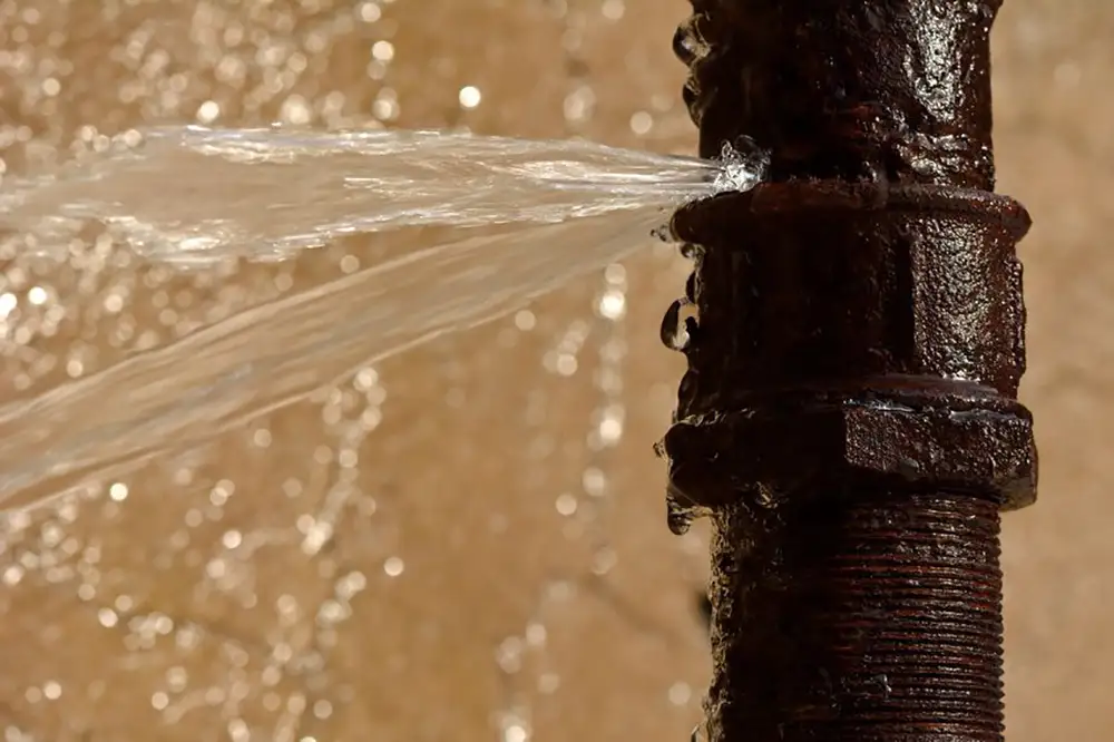
Unknown services are one of the highest-consequence risks on civil and building sites. Strikes can lead to serious harm (electric shock, gas ignition, flooding), public outages, emergency call-outs and claims. A competent locator identifies likely service corridors, confirms live assets in the field and pinpoints clear “no-go” zones, allowing you to plan safe methods of work, supervision and permits long before a bucket hits the ground.
Cost and programme certainty
Undiscovered services are a classic cause of rework. A late clash can force design changes, vary piling locations, re-align drainage runs, or trigger extra TMPs and approvals. By locating in feasibility or early design, you move risk forward—where changes are cheap. The outcome is fewer design iterations, reliable procurement, and realistic construction programmes.
Compliance and stakeholder management
Whether you’re on a private site, in the Auckland Transport corridor or near state highway assets, you’ll need accurate underground information to support approvals, temporary traffic management and permit conditions. Early locating makes those submissions smoother and reduces the likelihood of last-minute conditions or hold points.
How professional locator services work (and why tool choice matters)
Start with records, then verify on-site
Good practice starts with collecting existing information, including asset owner plans, easements, and previous surveys. But plans can be incomplete, out-of-date or non-representative. That’s why on-site verification is non-negotiable.
EMI (Electromagnetic Induction)
EMI induces and traces signals in conductive networks—ideal for power, many comms cables with tracer wires, and metallic gas/water pipes. It provides accurate alignment and, with the right technique, can help infer depth. Limitations: non-conductive assets (PVC, PE without tracer wire) may not respond, and congested sites can create signal ambiguity.
GPR (Ground Penetrating Radar)
GPR emits radar pulses that reflect from subsurface changes. It can detect conductive and non-conductive features: plastic pipes, concrete structures, ducts, voids and unknowns. Limitations: performance varies with soil moisture and clay content; antenna selection and experienced interpretation are critical.
Potholing (vacuum excavation)
For critical crossings (HV feeders, gas, trunk water, major comms) the only way to achieve “design-grade certainty” is to expose and measure. Selective potholes confirm exact depth, diameter and cover so engineers can lock in levels with confidence.
Bottom line:
pairing GPR + EMI and verifying with targeted potholes removes blind spots and yields dependable, design-ready data.
A practical workflow for Auckland projects
1. Feasibility / concept design
- Commission a desktop review and preliminary locate to understand constraints near proposed building footprints, drainage runs, crane pads and access routes.
- Identify risk corridors (e.g., likely HV, gas or trunk mains) and treat them as design inputs, not discoveries.
2. Schematic / detailed design
- Undertake full EMI + GPR mark-outs and survey pickups for CAD/BIM.
- Pothole high-risk interfaces and critical crossings to confirm cover, material and alignment.
- Provide geo-referenced deliverables (PDF plans, DWG, and if required, 3D utility features) to the design team.
3. Pre-construction
- Refresh network plans and mark-outs if validity windows lapse.
- Use the verified data set to support Corridor Access Requests and TMPs, and to brief supervisors on safe dig methods.
4. Construction / as-built
- Keep locating “live”: if levels shift or unforeseen services are suspected, rescan before proceeding.
- Capture updated positions for accurate as-builts and future maintenance.
What early locating unlocks for design engineers
- Better geometry decisions: drainage gradients, invert levels and cover requirements can be set around known constraints, not speculation.
- Fewer RFIs: when utility corridors are confirmed, design packages are clearer, and site teams ask fewer “what if” questions.
- Coordination that sticks: DWG/BIM-ready layers drop straight into your model, enabling clash detection across structures, stormwater, wastewater, utility relocations and staging.
If you’d like to see how this lands in practice, talk to us about packaging utility data with survey control and topographic surfaces so your team starts with a coherent base file rather than a pile of PDFs.
Auckland-specific considerations
- Dense, mixed corridors: infill development and legacy networks mean multiple assets can occupy the same verge or carriageway. Expect crossings, abandoned plants and undocumented private laterals.
- Traffic management impacts: accurate underground information reduces mid-shift surprises that force additional TMP adjustments and day works.
- Flood and ground conditions: high groundwater and variable soils affect GPR clarity, experienced antenna selection, and data interpretation matter.
- Stakeholders: utility owners, Auckland Transport, Kāinga Ora sites, schools and healthcare campuses often have additional safety rules. Clear utility data helps you meet them without delay.
What you’ll receive from Precision Site Solutions
- On-site EMI + GPR mark-outs, with clear colour coding and risk notes.
- Survey pickups tied to your control, delivered as PDF plans, DWG (and BIM-ready exports on request).
- Targeted potholing for critical services, including chainage, depths, material and photo evidence.
- Plain-language reporting that documents methodology, limitations and confidence levels so you can make informed decisions.
- Coordination with designers and contractors to integrate findings into construction sequencing and CAR/TMP documentation.
Explore more about our capabilities on Underground Services Location
Practical tips for your next project
Scope early, scope smart:
Specify EMI + GPR with selective potholing in your RFPs so all bidders price the same risk profile.
Ask for geo-referenced data:
Stipulate DWG/BIM deliverables with layers named to your CAD standard.
Focus on potholes where they matter:
Crossings, tight cover, HV/gas interfaces, and near critical structures or plant pads.
Keep it current:
If works slip, refresh plans and mark-outs; utility networks and site conditions change.
Brief the site team:
Convert locate outcomes into practical controls, no-dig zones, hand-dig areas, exclusion zones and hold points.
Record improvements:
Capture new or corrected positions in your as-builts to reduce risk for the next stage of work.
Frequently Asked Questions
When should we book a locate?
As early as possible, ideally during the feasibility or schematic design phase. Early intelligence reduces the chance of redesigns and keeps procurement and programme realistic.
We already have network plans. Do we still need on-site locating?
Yes. Plans serve as a starting point, not proof of an exact position or depth. On-site locating verifies reality and often uncovers undocumented assets and private laterals.
Is GPR enough on its own?
Not reliably. Soil conditions, moisture and target materials can limit GPR visibility. Pair GPR with EMI, and pothole where risk warrants it.
What level of accuracy should we expect?
Expect different confidence levels depending on method. Instrument-detected services provide reliable horizontal alignment; potholing confirms exact depth and diameter. We’ll clearly state confidence and any limitations in our report.
Can you deliver CAD/BIM-ready outputs?
Absolutely. We deliver geo-referenced PDF plans and DWG files as standard, and can supply BIM-friendly exports or 3D utility features on request.
Will you mark out private services?
Yes, where accessible and detectable. Many risks are on private property networks, so we include those in our scope where relevant.
How does this help with Corridor Access Requests (CARs)?
Accurate utility data supports safer methods, clearer TMPs and fewer conditions or hold points, which saves time and reduces mid-shift changes.
Do you operate beyond Auckland?
Yes, we do. Auckland is our core service area, and we can support projects outside of this area by arrangement.
Conclusion:
Design out risk, don’t dig into it
The most successful projects in Auckland treat underground utilities as a design input, not a construction surprise. A professional locator service engaged early, combining GPR + EMI and selective potholing, gives your team the certainty to plan safely, coordinate stakeholders and deliver on time. It keeps people safe, protects critical infrastructure and preserves programme and budget.
Ready to de-risk your next site?
Book an early-phase locate with Precision Site Solutions.
We can also align your locate scope with concrete scanning, 3D scanning and survey control so designers and site teams are working from the same accurate base.