Underground Services Locators
Reduce Risks with Our Underground Service Locator Expertise
Navigating the intricate underground asset network in Auckland requires skilled precision, especially when embarking on construction or civil works projects. Ignoring the complexities of the underground utility grid on your worksite could pose substantial risks. As a dedicated team of underground service locators, we’ll keep everybody safe.
Before you dig, call 022 477 2341.
Those risks are…
1 - Safety
2 - Costs
3 - Customer Expectations
Customers, whether private or stakeholders for public assets, take a dim view when it comes to damages to costly assets. Especially when that damage is usually very preventable.
Expert Location Services
At Precision Site Solutions, our expert team uses state-of-the-art technology to provide precise and comprehensive underground service location details for your projects. Whether it’s residential, commercial, or industrial sites across Auckland and beyond, our locators ensure you have a complete understanding of all underground utilities, including cables and pipes. Trust our experience and reliability for peace of mind and smooth project operations.
Don’t leave your project to chance, get in touch with us for a thorough assessment of your underground assets.
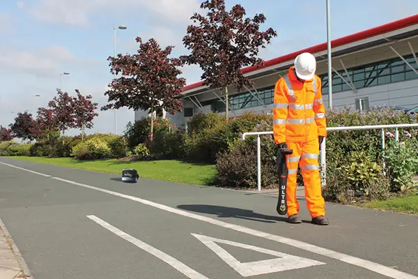
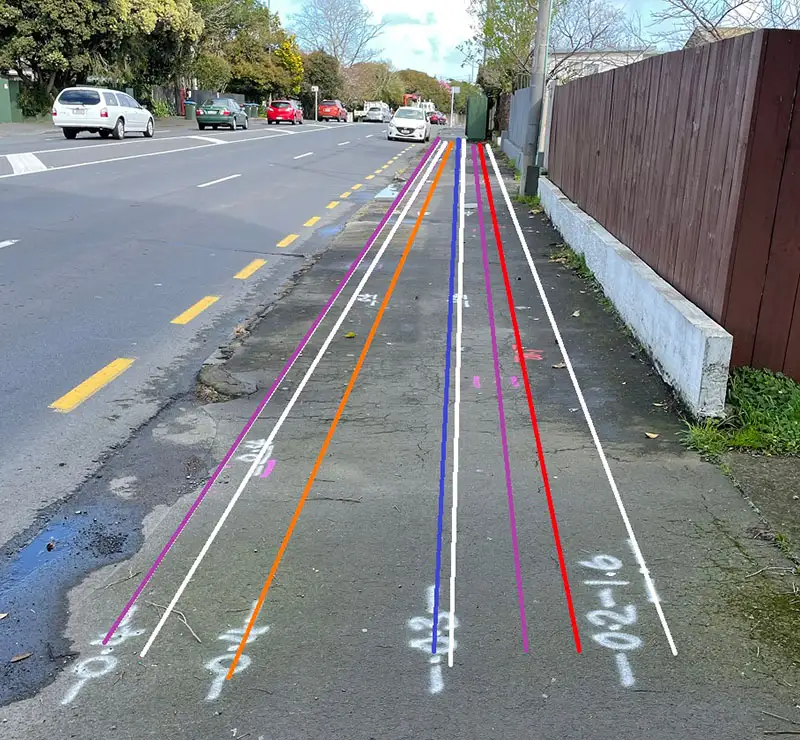
The types of services we can locate include:
- Power
- Gas
- Communications, including the internet
- Water
- Stormwater
- Wastewater
- Chorus
- Fibre
At Precision Site Solutions, we can work on any size project. We have experience providing our location services on residential, commercial, and industrial sites, as well as on public properties, schools, universities, healthcare sites and more. We are also providers to the Ministry of Education.
We advise, and we can provide the “full picture” on your next project and we provide customised services, so we can tailor our approach according to your requirements.
Detection Services We Provide
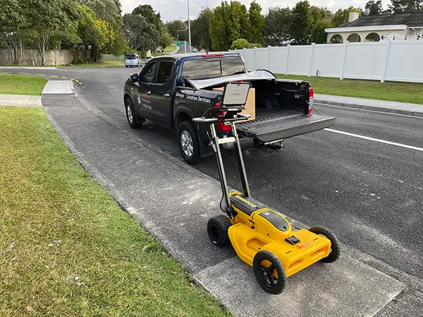
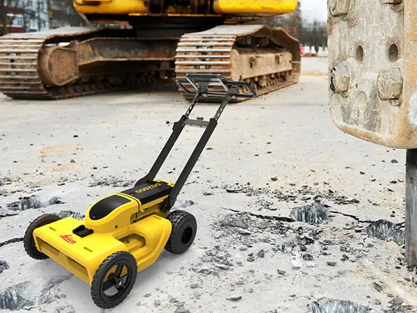
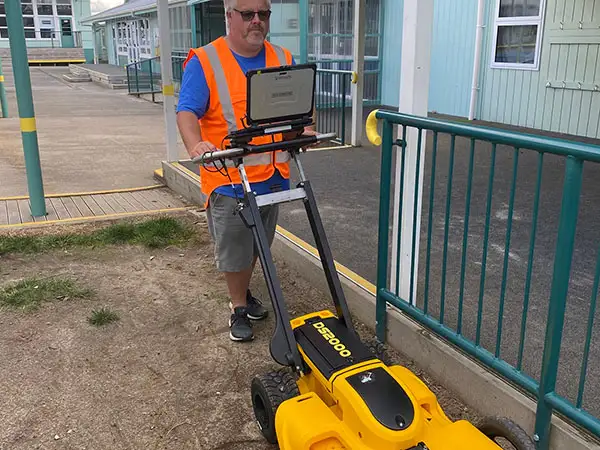
G.P.R. – Ground Penetrating Radar (GPR)
Advanced Technology: Utilises electromagnetic pulses, GPR is perfect for detecting both metallic and non-metallic utilities in various ground conditions.
Precision: Our high-resolution GPR services offer detailed underground mapping, reducing the risk of hitting utilities during excavations.
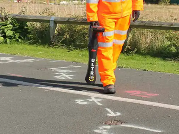
E.M.I. – Pipe and Cable Locating
Efficient Locating: Identifies power and telecommunications lines swiftly and accurately, aiding safer project planning.
Advanced Equipment: Precision Site Solutions utilises state-of-the-art cable locators for precise underground utility detection.
Deliverables
Having a strong background in surveying, we can provide a geo-referenced survey (pdf/dwg) of your underground assets so your job of conveying this information to 3rd party users is easier.
At Precision Site Solutions we understand that every client is after the “full Picture” and that costly delays due to damaged assets are never a good look. Only with a combination of both GPR and EMI can we provide “the full Picture”.
Geo-Referenced Survey Data and Plans
If you’re looking at retaining the service information for your property, then we can help. We can provide a fully comprehensive package to our customers, including survey quality plans, reports, and digital data for designers if requested. Call us today to discuss the options for your next project.
Planning a project? Know what’s underground before you design.
If you’re in the early planning or design phase of a project, it’s critical to identify underground services before design work begins. Our pre-design locating services support engineers with accurate, CAD-ready data that helps avoid service clashes, redesign delays, and budget blowouts.

Frequently Asked Questions
about Underground Services Location
When should I commission a utility locate service?
As early as possible, ideally during feasibility or early schematic stages. Early locates reduce the risk of redesign, save cost, and help validate site layouts before resource consent or detailed design.
What is SUE and why does it matter?
Subsurface Utility Engineering (SUE) is a structured methodology for locating and classifying underground utilities. It uses defined Quality Levels (D–A), with B and A levels being essential for design-grade accuracy. SUE minimises risk, liability and hidden costs.
How accurate is your data?
Quality Level B gives ±0.5 m horizontal accuracy; Level A ensures precise horizontal + vertical positioning, verified via exposed test holes. This is fundamental for avoiding costly clashes and unplanned relocations.
Can your data integrate with our CAD/BIM?
Absolutely. We deliver CAD, MicroStation or BIM‑ready files and when needed, conceptual 3D utility models to streamline handoff to your design team.
What technologies do you use?
GPR, electromagnetic locators, vacuum excavation, CCTV (if pipes inspected), and CAD/GIS-enabled survey equipment. We adhere to PAS128, ASCE 38‑02 and NZ Utility Search guidance.
How will it help my project?
Early identification of utility clashes allows you to:
-
Enforce design around existing services
-
Avoid resource consent hold‑ups
-
Eliminate contractor fines/delays
-
Reduce risk and rework in detailed design and construction
What if my design changes later?
We can perform follow‑up locates—either re‑pot holing or re‑scanning—so your utility plan remains current throughout delivery.
What's the difference between a locate and a utility survey?
A locate identifies and marks the position of underground services on-site, typically shown with paint or flags. A utility survey goes further by providing geo-referenced coordinates tied to survey control, delivered as PDF plans or CAD/DWG files. Surveys are essential when you need to integrate utility positions into design drawings, coordinate with other disciplines, or maintain records for future work.
How do you verify BeforeUDig plans on site?
We always review BeforeUDig records before fieldwork begins. These plans are useful but can be incomplete or outdated. Our locating process verifies the actual location of known services and highlights additional or conflicting assets not shown on the plans. This confirmation step helps contractors avoid relying solely on paper records and ensures safer excavation and design decisions.
What happens if you find undocumented services?
Undocumented or unmapped services are common, particularly private laterals, abandoned plant, or legacy infrastructure. When we identify these, we include them in our mark-outs and reports with notes on their likely function and confidence level. This information helps you adjust designs, notify relevant parties, or arrange targeted potholing for confirmation before proceeding with works.
Call us today to discuss the options for your next project.
We provide comprehensive services location solutions and surveyor services.